Thunderstorms
Objective
Understand the formation, classification, and lifecycle of thunderstorms, identify associated aviation hazards, interpret relevant weather products, and apply established safety strategies for avoidance and inadvertent encounters.
Timing
- 45 minutes
Format
- Whiteboard
- ForeFlight weather products
Overview
- Conditions Required for Thunderstorms
- Thunderstorm Lifecycle
- Air Mass Thunderstorms
- Steady State Thunderstorms
- Squall Line Thunderstorms
- Embedded Thunderstorms
- Frontal Thunderstorms
- Hazards Associated with Thunderstorms
- Forecasts Associated with Thunderstorms
- Radar Summary Chart
- Convective SIGMETs
- Thunderstorm Avoidance Strategies
- Inadvertent Thunderstorm Encounter Strategies
Elements
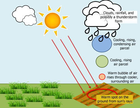
Conditions Required for Thunderstorms
Three essential ingredients:
- Water vapor
- Unstable air
- A lifting mechanism
- Conditionally unstable air allows for release of convective energy
- Lifting mechanisms: converging winds, fronts, upslope flow, drylines, or local wind circulations
- A rapid decrease in temperature with altitude may indicate an unstable air mass
Thunderstorm Lifecycle
Three distinct stages: Towering Cumulus, Mature, and Dissipating
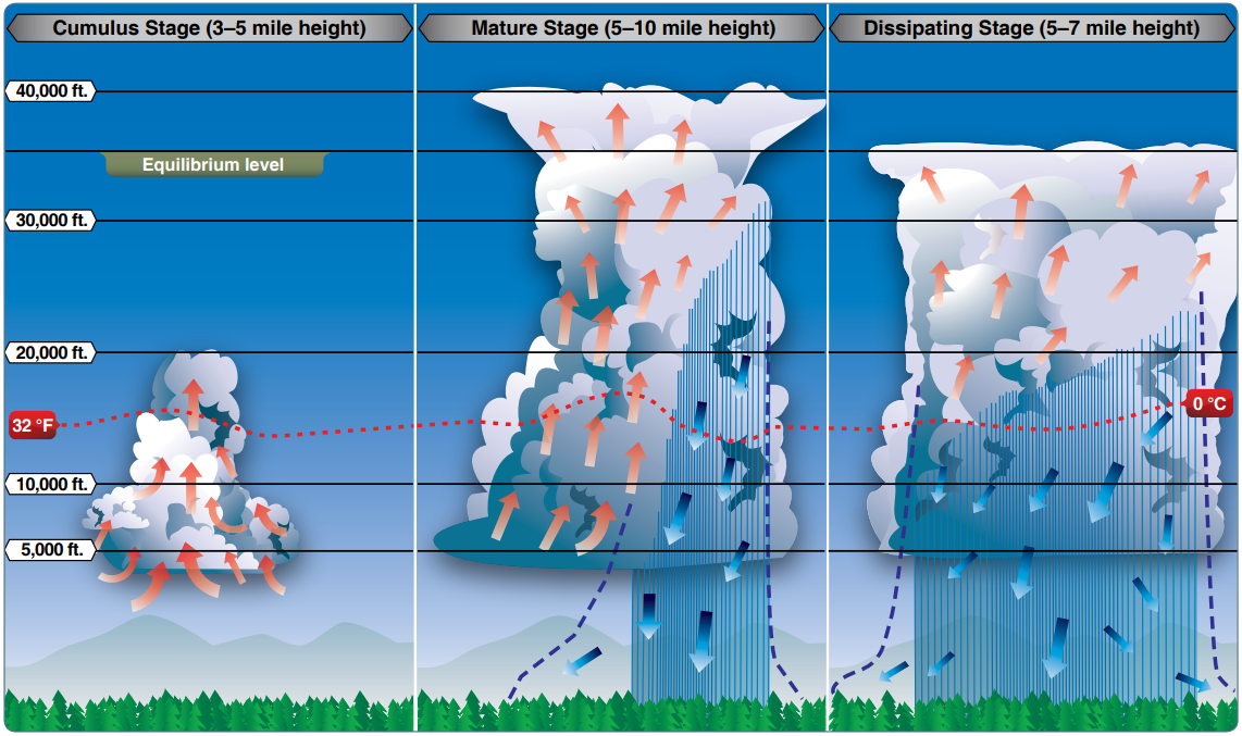
- Towering Cumulus stage features strong updrafts exceeding 3,000 fpm
- Mature stage features both updrafts and downdrafts; hazards at peak intensity
- Dissipating stage dominated by downdrafts as moisture supply is cut off
Air Mass Thunderstorms
- Form on scattered basis due to uneven surface heating and instability
- Also called popcorn convection
- Typically small, short-lived, and rarely severe
- Usually dissipate shortly after sunset and heating of the ground stops
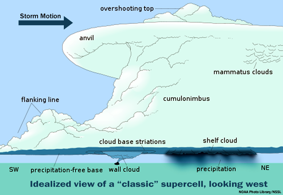
Steady State Thunderstorms
- Supercells are long-lived (more than 1 hour) thunderstorms
- Characterized by significant instability, strong surface winds
- Supercells are typically "tilted"
- Rain falls ahead of the storm, outside of the updraft, preventing the storm from collapsing on itself
- Updrafts of supercells are commonly larger than a typical thunderstorm
- Can be as large as 10 miles in diameter and up to 60,000 feet tall
- Updraft speeds can reach 9,000 fpm or 100 knots
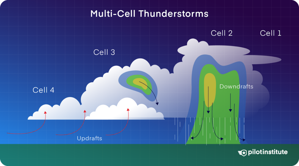
Squall Line Thunderstorms
- Narrow band of active cells extending hundreds of miles
- Often form ahead of cold fronts associated with midlatitude low pressure systems
- Generate approximately 25 percent of all U.S. tornadoes
- Most effective barrier to air traffic due to height and length
Embedded Thunderstorms
- Thunderstorm cells obscured by massive cloud layers
- Difficult to circumnavigate visually
- Differentiated in SIGMETs as EMBD TS
Frontal Thunderstorms
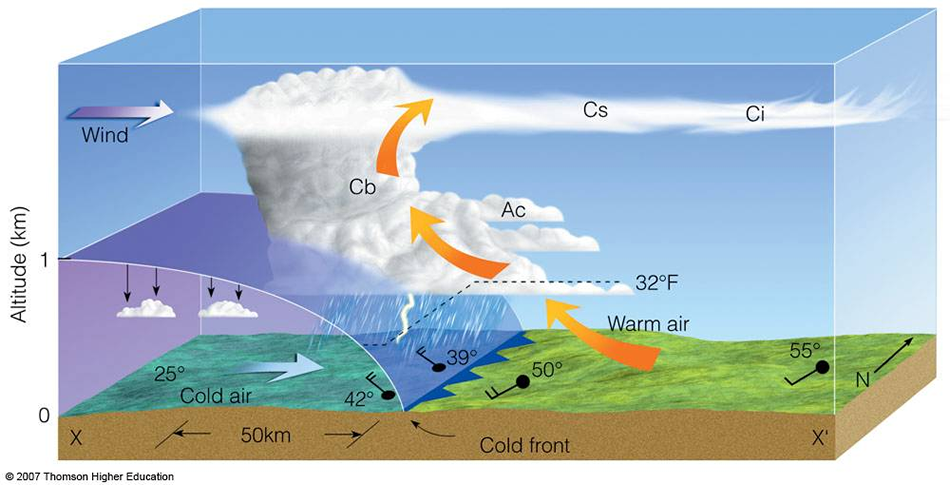
- Triggered by cold, warm, or occluded frontal lift
- Cold fronts act as a snowplow, forcing air upward abruptly
- Warm fronts produce gradual lift, leading to widespread stratiform clouds and embedded cells
- Can occur in a narrow band along the frontal boundary
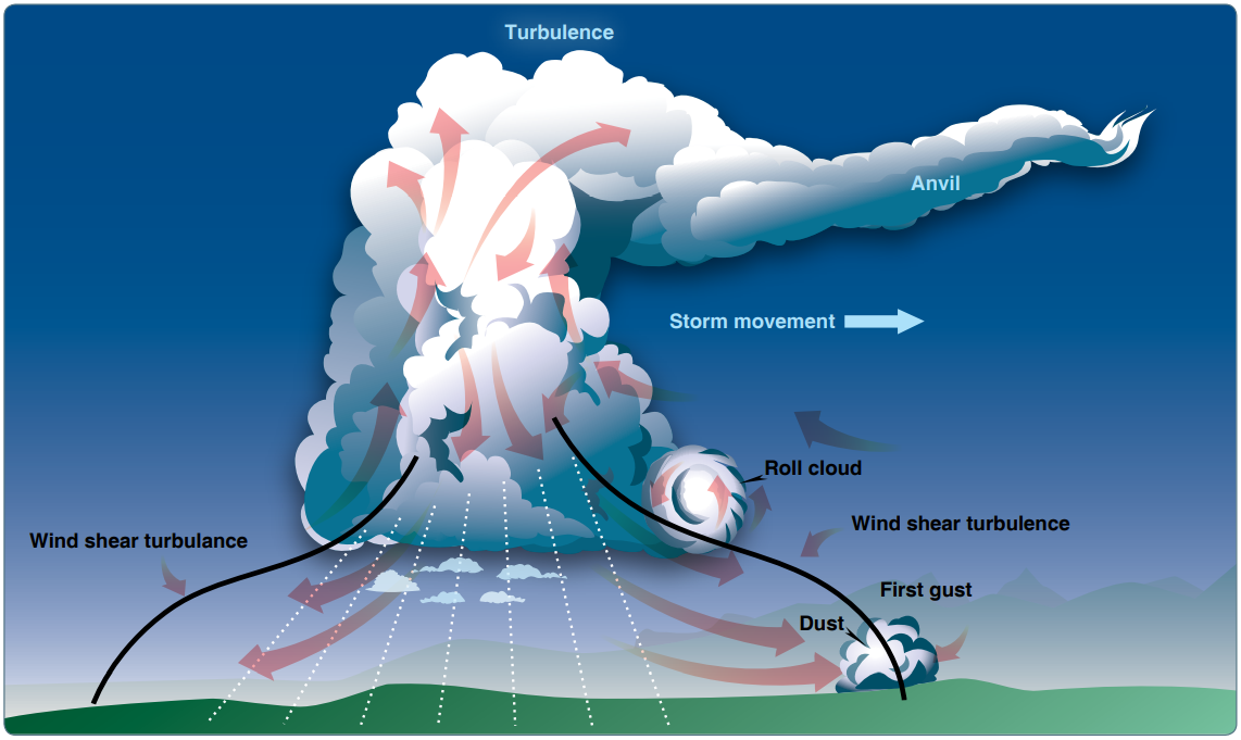
Hazards Associated with Thunderstorms
- Severe turbulence exists between updrafts and downdrafts
- Greatest turbulence is found around the perimeter of the storm, where the stormy air is mixing with the air around it
- Usually the turbulence is strongest on the front side of the storms
- 20 fpm gusts: Moderate turbulence, 30 fpm gusts: Severe turbulence
- Gust fronts can extend 15-20 miles in front of a strong storm; surface winds can change rapidly in speed and direction
- Hailstones ≥0.75 inches cause significant structural damage
- Lightning strikes most common at temperatures between -5°C and +5°C
- Static electricity (P-static) can cause complete loss of VHF communications
- Tornado wind speeds can exceed 200 knots
- Rapid pressure changes can cause altimeter errors > 100 feet
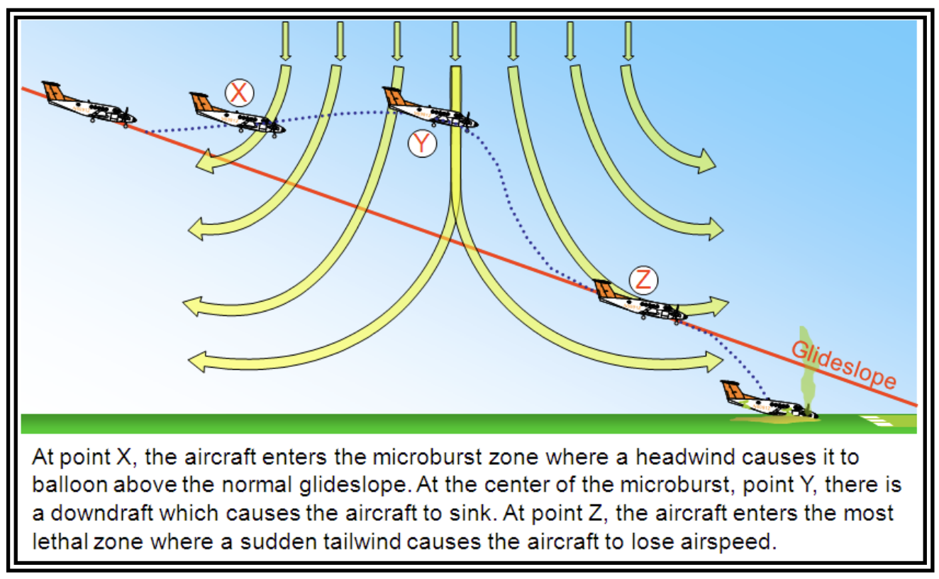
Microbursts
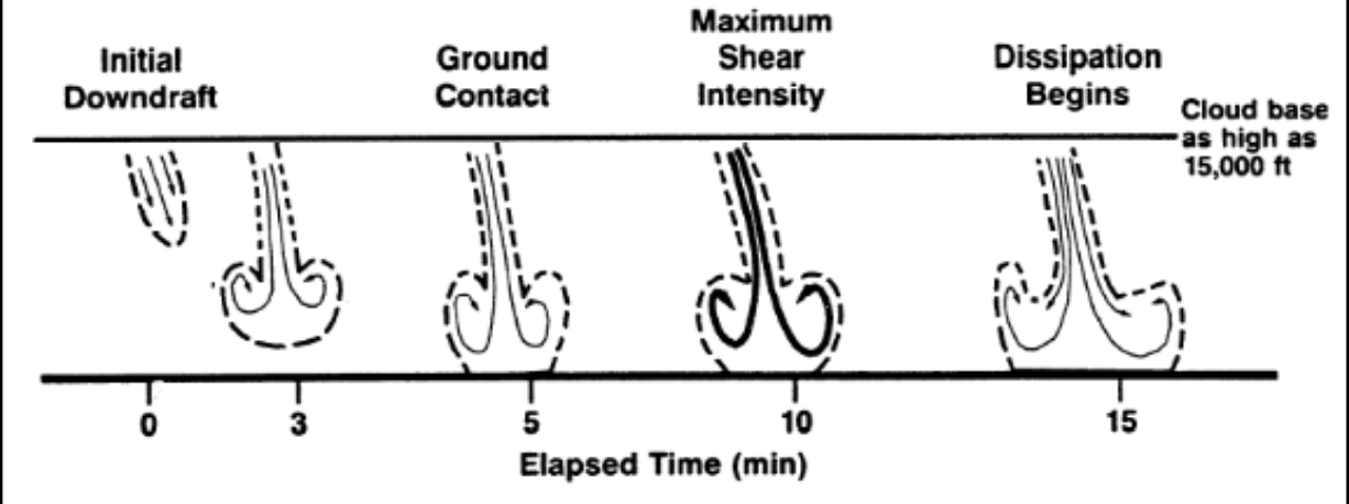
Microbursts produce downdrafts up to 6,000 fpm and headwind losses of 30–90 knots
- Microbursts are small-scale, intense downdrafts that spread out symmetrically when reaching the ground
Forecasts Associated with Thunderstorms
- Terminal Aerodrome Forecast (TAF) provides point-specific thunderstorm projections
- Convective Outlook (AC) forecasts severe potential over 8 days
- Graphical Forecasts for Aviation (GFA) website displays forecast TS areas
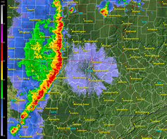
Radar Summary Chart
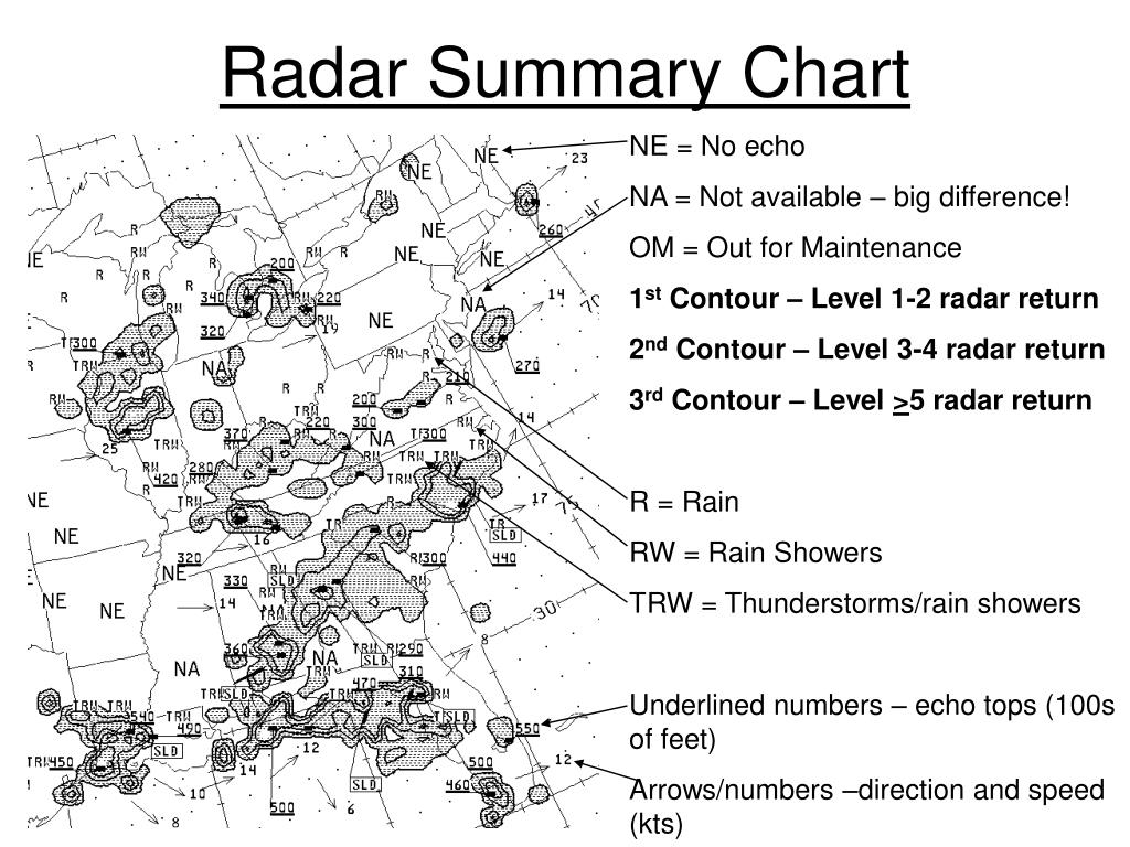
- Graphically depicts collection of radar weather reports (SDs)
- Shows precipitation intensity, echo tops, and cell movement
- Identifies weather watches using heavy dashed lines
- NE indicates no echoes detected; NA indicates no information
Convective SIGMETs
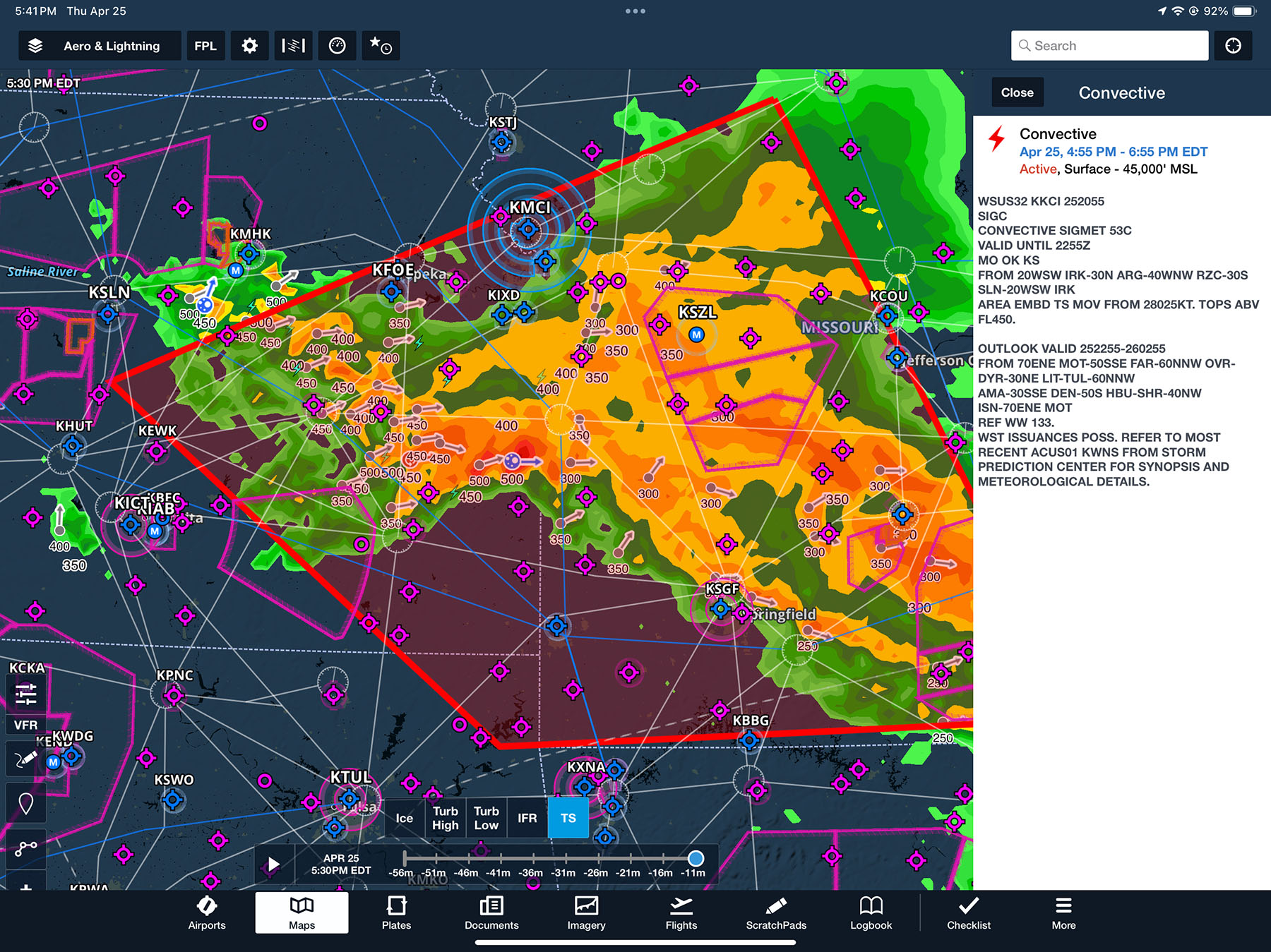
- Coded as WST
- Issued hourly at H+55 for Eastern, Central, and Western U.S.
- Valid for up to 2 hours
- Criteria:
- Surface winds >50 knots, hail ≥3/4 inch, or tornadoes
- Tornadoes, lines of thunderstorms, embedded or severe thunderstorms
- Area of very strong storms affecting 3000 square miles and covering at least 40% of the area
- Based on a convective outlook, which is also available
Thunderstorm Avoidance Strategies
Avoid thunderstorms by at least 5 miles, and 20 miles for severe storms.
- Avoid by at least 20 mi any thunderstorm identified as severe or giving an intense, heavy, or extreme radar echo
- Especially true under the anvil of a large cumulonimbus
- Large echoes should be separated by at least 40 mi before flying between echoes
- Separation distances may be reduced for avoiding weaker echoes.
- Regard any storm with tops >35,000 feet as extremely hazardous
- Circumnavigate areas with 6/10 or more thunderstorm coverage
- Do not land or take off in the face of an approaching thunderstorm
- Do not fly under the anvil of a thunderstorm due to clear-air turbulence (CAT) risk
Aviation Weather Handbook pg. 22-21
Inadvertent Thunderstorm Encounter Strategies
- Maintain a straight course through the storm to minimize time in hazards
- Set power for recommended turbulence penetration speed (VA)
- Focus on maintaining a level attitude; allow altitude and airspeed to fluctuate
- Disengage Altitude Hold and Speed Hold modes on autopilot
- Turn cockpit lights to maximum to reduce lightning blindness
Aviation Weather Handbook pg. 22-22
References
- Aviation Weather Handbook: 22-1 to 22-21, 24-3, 24-5, 24-36, 26-2 to 26-10, 27-7 to 27-21
- Instrument Flying Handbook: 2-11, 10-24 to 10-25, 11-2
- Instrument Procedures Handbook: 4-5, A-1
- Aeronautical Information Manual: 7-1-26, 7-1-27
- Backseat Pilot CFI-I Lesson Plans: III.A (Weather Information), III.A (Weather Theory)
- Purdue Thunderstorms