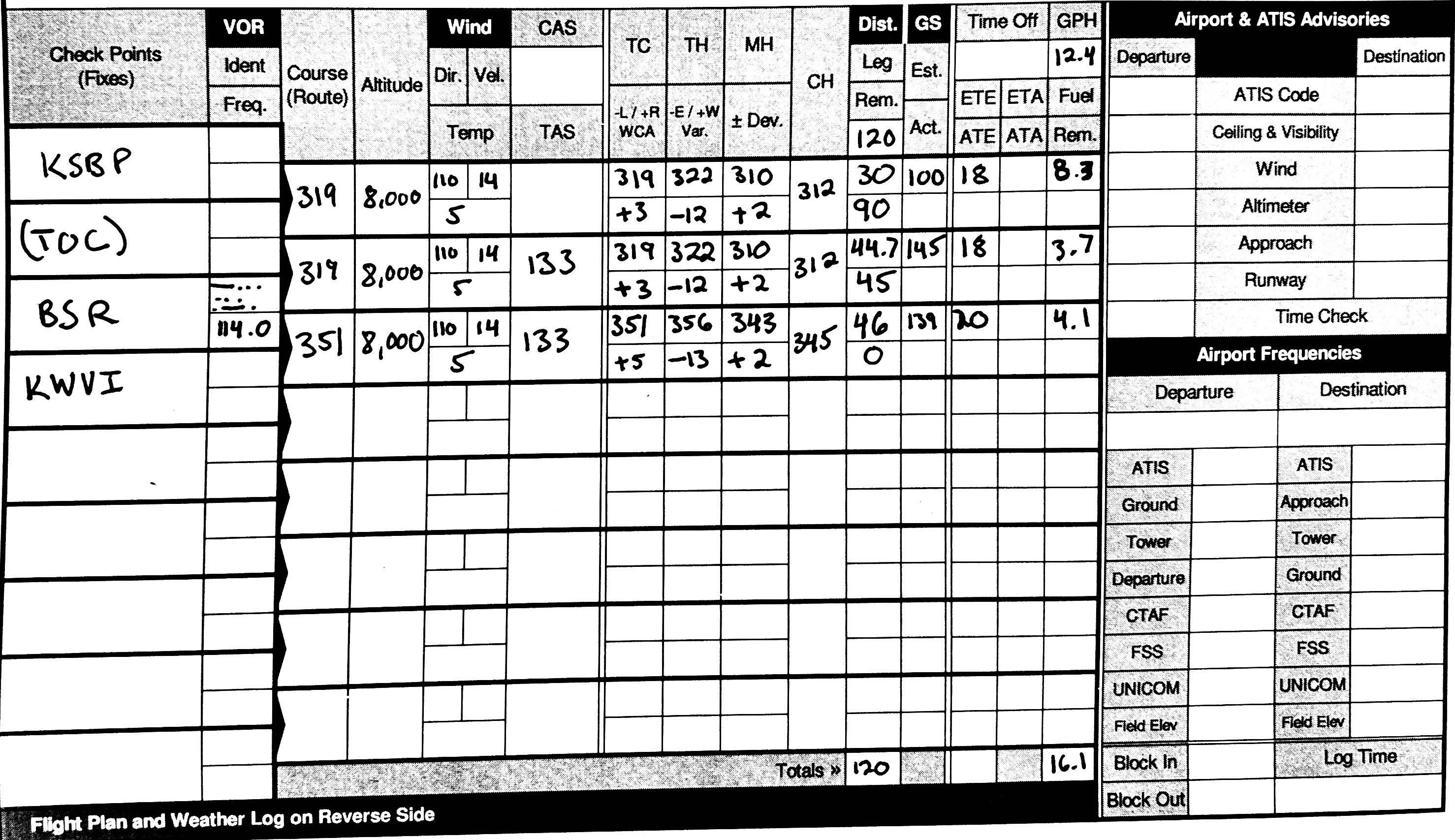
Sample Problem: Flight Plan KSBP to KMRY
Winds Aloft
DATA BASED ON 151800Z

VALID 160000Z   FOR USE 2000-0300Z. TEMPS NEG ABV 24000FT  3000    6000    9000   12000   18000   24000  30000  34000  39000
SBA 9900 1112+11 1414+06 1718-01 1830-18 2042-29 216545 217651 226955
SFO 2112 0411+10 1114+05 1217-03 1217-19 1813-30 172646 162456 192955
- Write down each flight plan waypoint, including a TOC (top of climb) waypoint after the origin, also write our cruising altitude.
- Route:
KSBP (TOC) BSR KWVI
- Route:
- Using a plotter or EFB, determine true course (TC) and the distance between each waypoint:
- 319°, 319°, 351°
- 74.7nm, 45.8nm
- Using the winds aloft forecast, write down the wind. (We'll use the SFO numbers since its the closest station, and has similar values to 9000.):
- 110 °T @ 14 knots
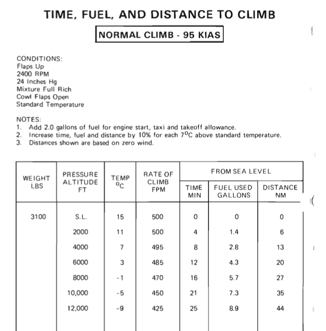
- Use the Time, Fuel, and Distance chart to determine approximate climb.
- We're start approximately at S.L., so use the 8000' line:
- 16 minutes, 5.7 gal, 27nm
- Temperature is 5°, or 6° above standard, so we'll increase 10%:
- 18 minutes, 29.7nm, plus 6.3 gal + 2 gal for taxi = 8.3 gal
- Write down 30nm for the TOC distance, then (74.7nm - 30nm) = 44.7nm for the TOC to BSR leg
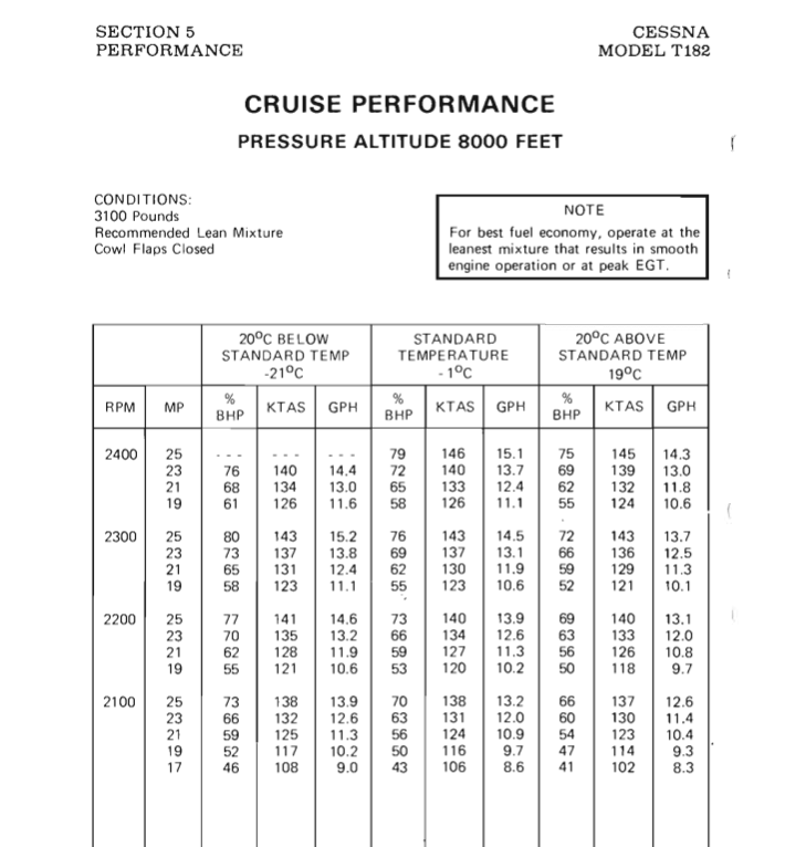
- Determine the TAS of the first leg: Using the 8,000' Cruise Performance Chart
- Located the 2200 RPM, 23" of manifold pressure line
- Interpolate between the -1°C a30 nd the 19°C temp values.
- 12.4 gph and 133 KTAS
- Determine ground speed of first leg.
- Using an flight computer, compute the WCA
- Wind 110° @ 14 knots, TC 319° T, TAS 133 knots
- Result: 145 knots GS, HDG 322° WCA +3°
- On the sectional chart, find the closest isogonic line.
- Enter and subtract 12° E from the first leg
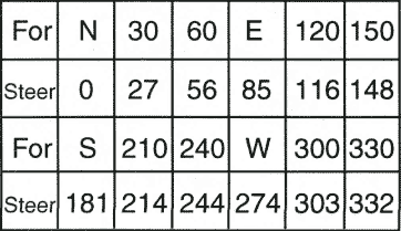
- Refer to the compass correction card for your airplane, find the closest entry to the heading to the magnetic heading
- For 330 steer 332, so +2
- Add +2 to get the MH of 312
- Repeat steps 6-8 using the values for the BSR - KWVI leg
- Subtract the leg distances for each distance remaining
- Use distance / GS = ETE to compute ETE for each leg
- Use the (ETE / 60) * GPH to compute GPH for each line